Understanding Pittsburgh's cultural identity through an speculative urbanism lens: the a network of culture and goods production through the necklace of sites in Pittsburgh. (Individual and group project)
Culture, Identity, Operation:
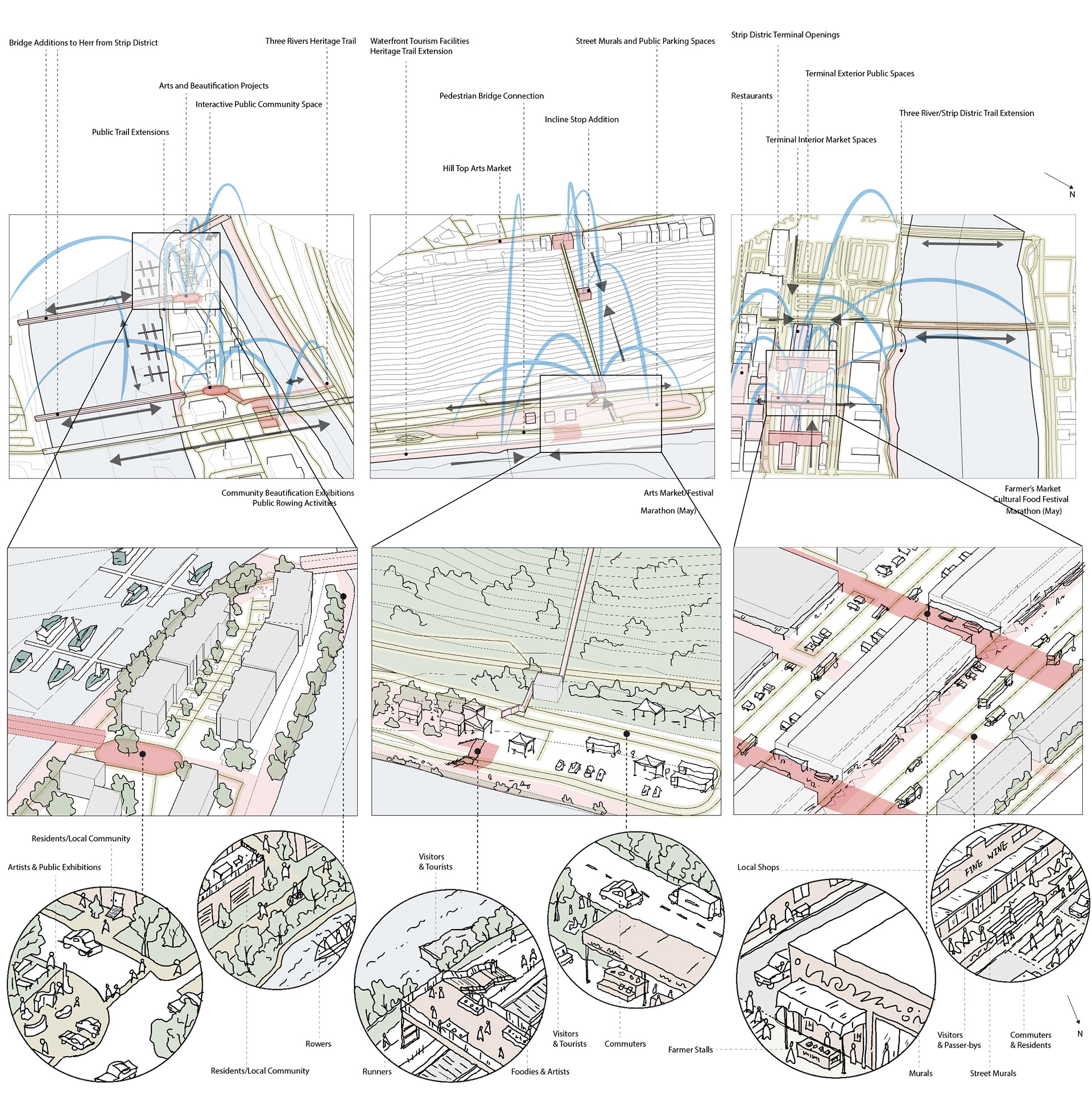
Three original sites, South Shore, Herr's Island, and Strip District, are each considered through the uniqueness of its own location and in context with the other, revealing the cultural identities and their significance in Pittsburgh.
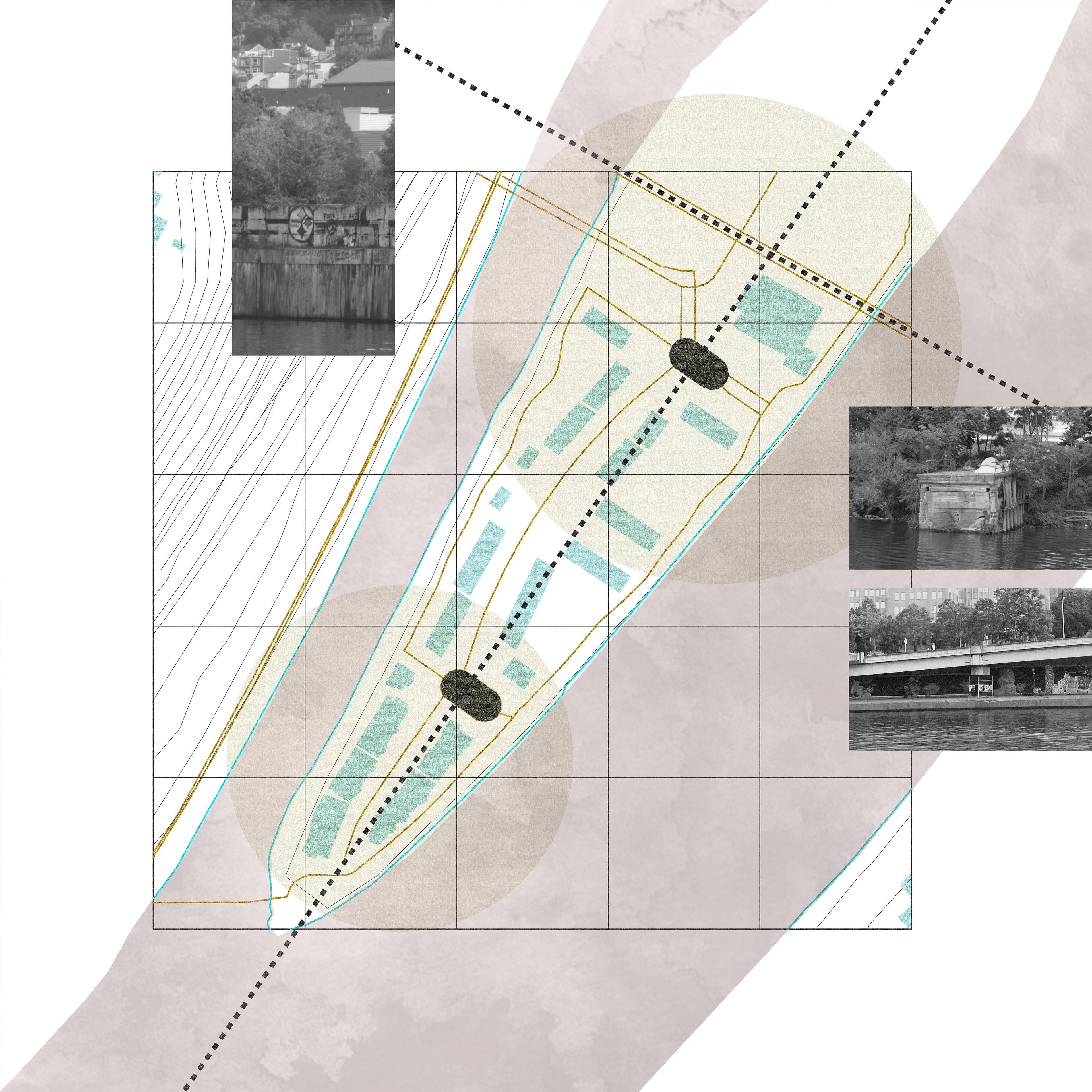


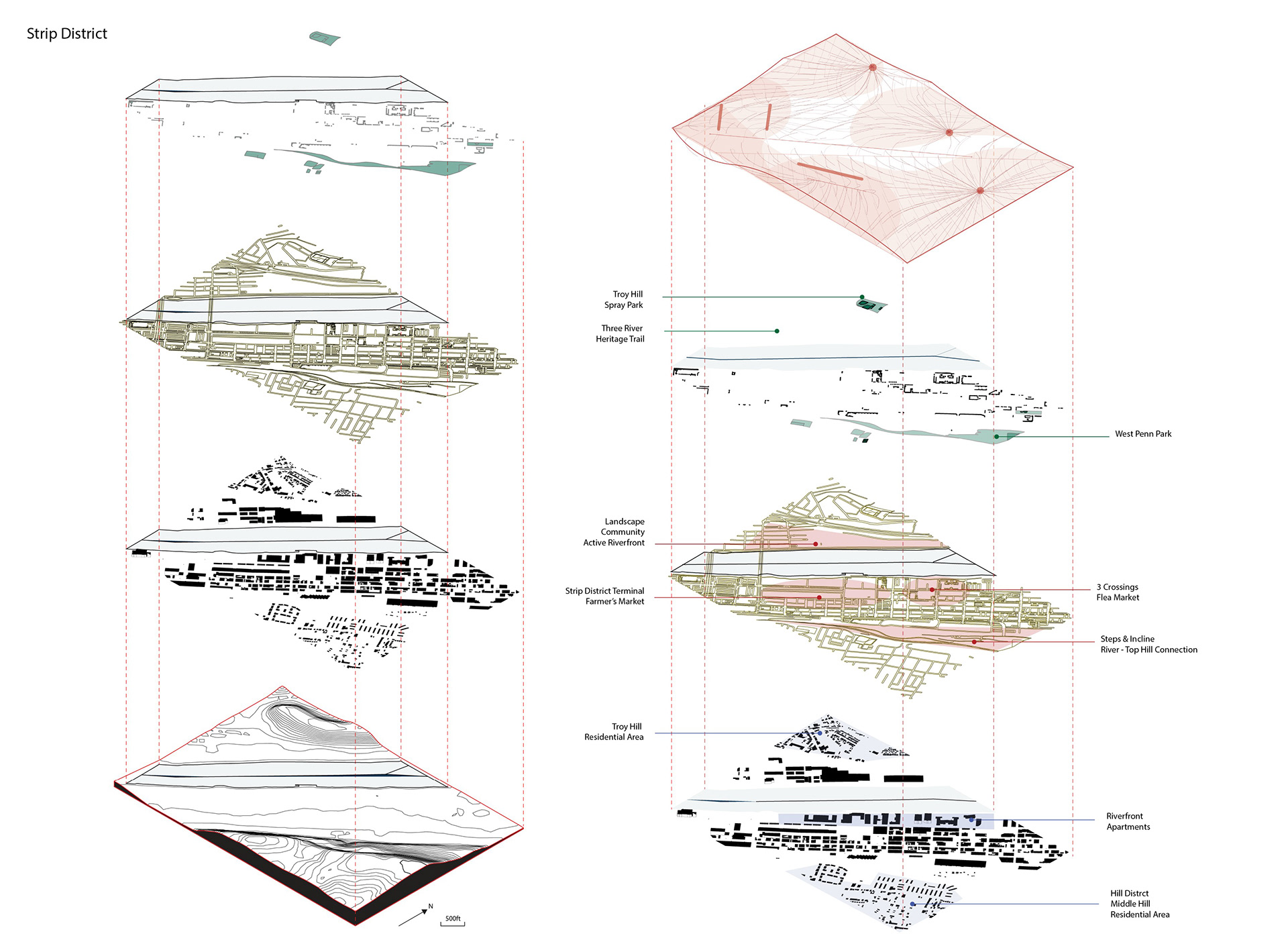
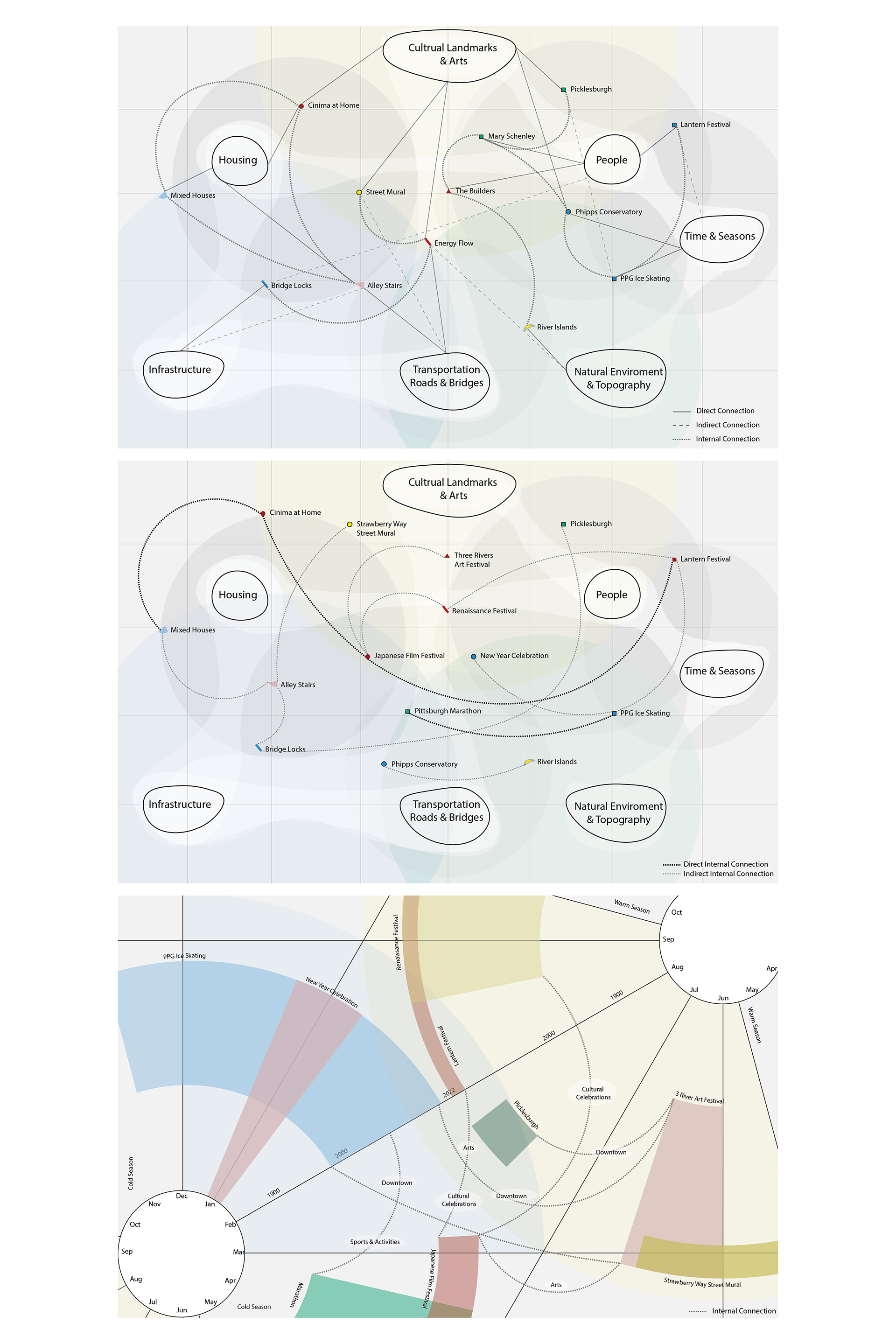
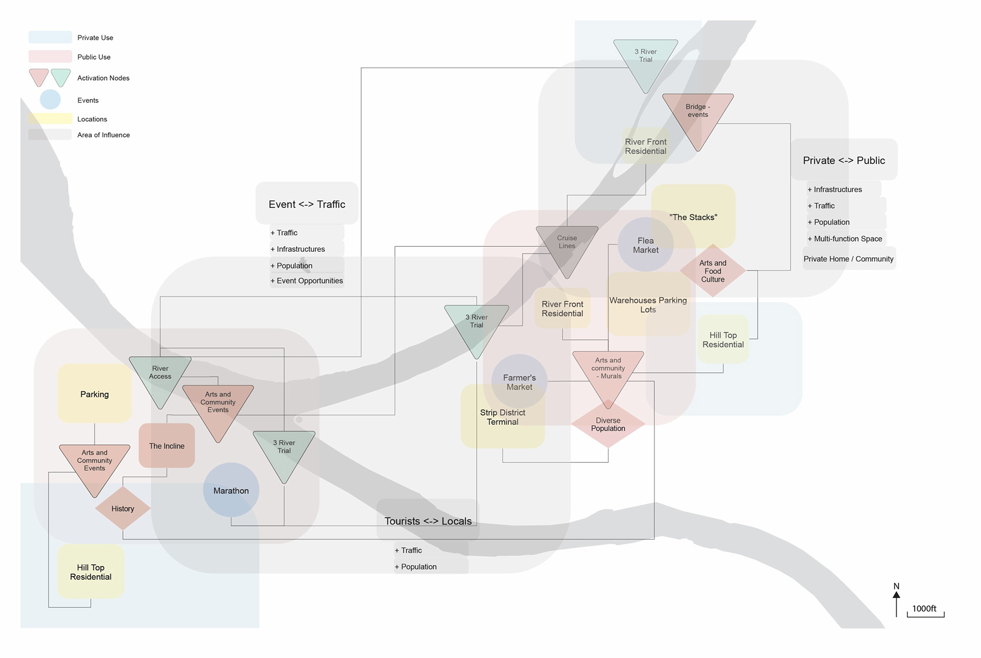

People, places, things, events, are collections of culture and context of a space. The study reveals Pittsburgh's industrial past, issues of gentrification and separation, as well as an abundance and a discontinuity between the art and food culture with residential spaces.
site alternative speculations
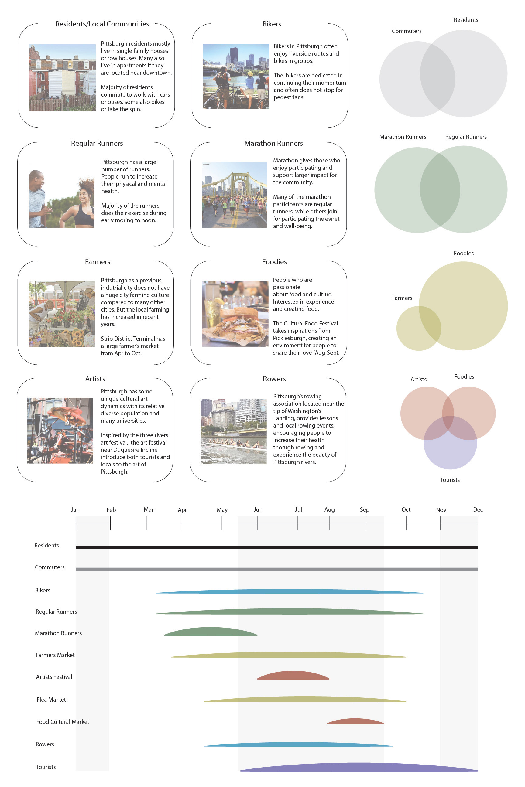
people and events
Precedents Studies and Typological Speculations:
Independent from the three previous sites, the research take on three precedents, The Sunken Bridge as an infrastructure, The Pittsburgh Art Festival as an event, and the Treehouse Co-living apartments as a residential space. Then through speculation and hybridity, one can explore the possibilities of "constructed identity".
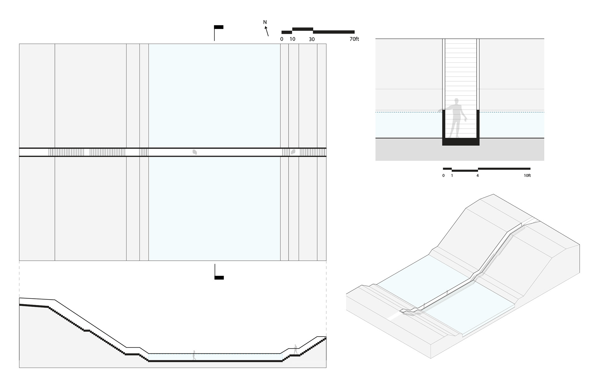
Precedent Study : Infrastructure: Sunken Bridge by RO&AD

Precedent Study : Residential: Treehouse Co-living Apartments by bo.daa
Precedent Study : Event: Pittsburgh Art Festival
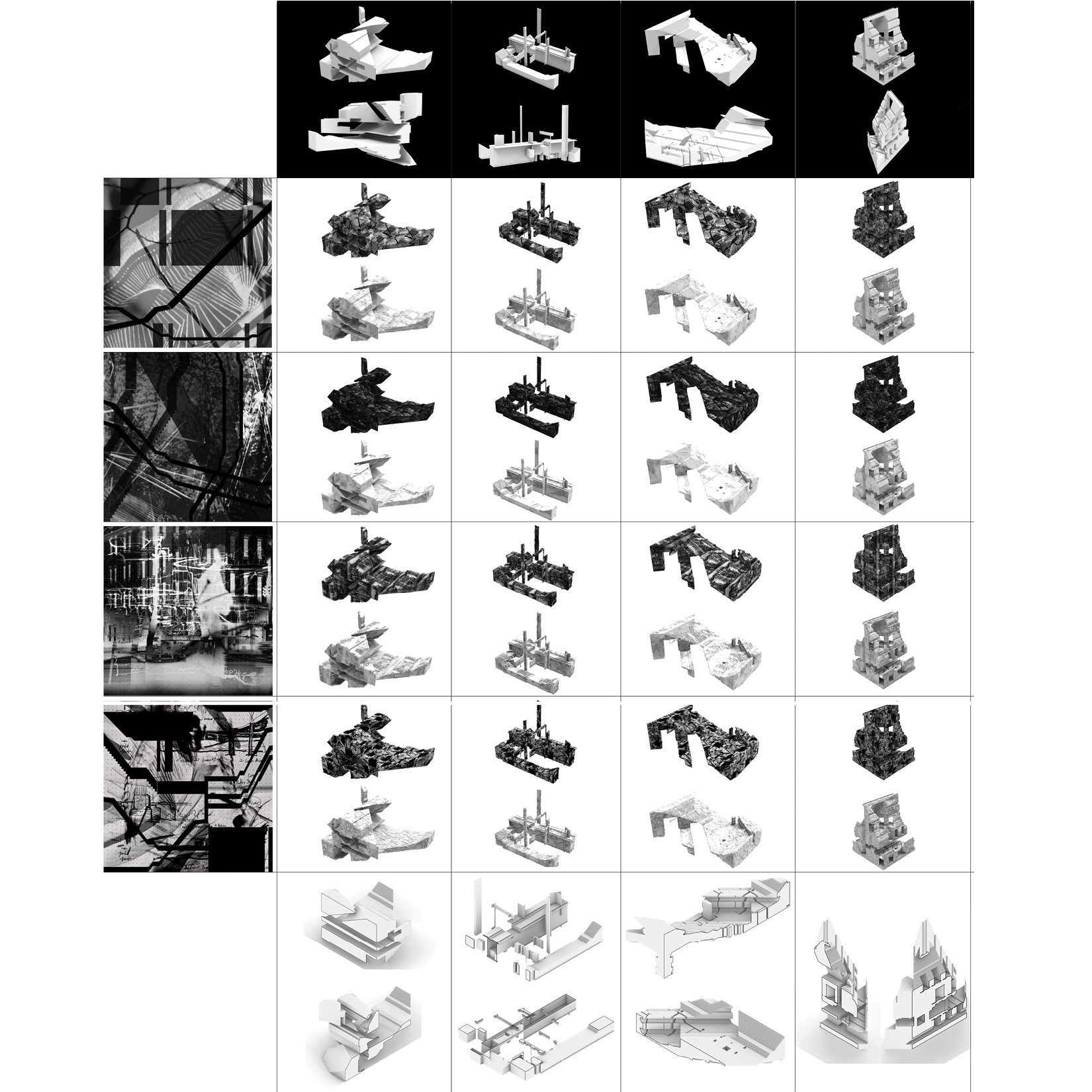
3D collages - formal explorations

precedents' hybrids
Site, Culture, Identity:
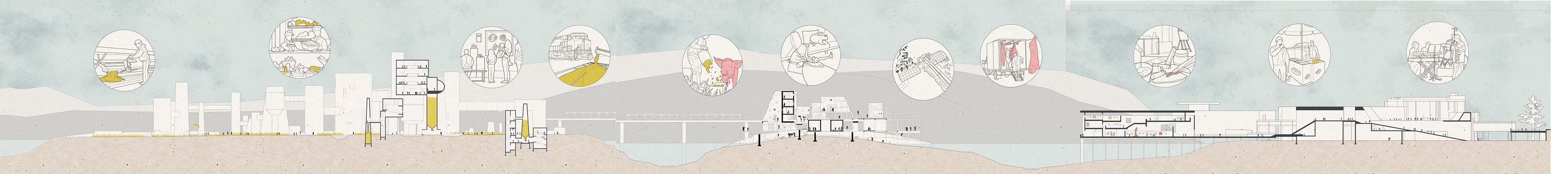
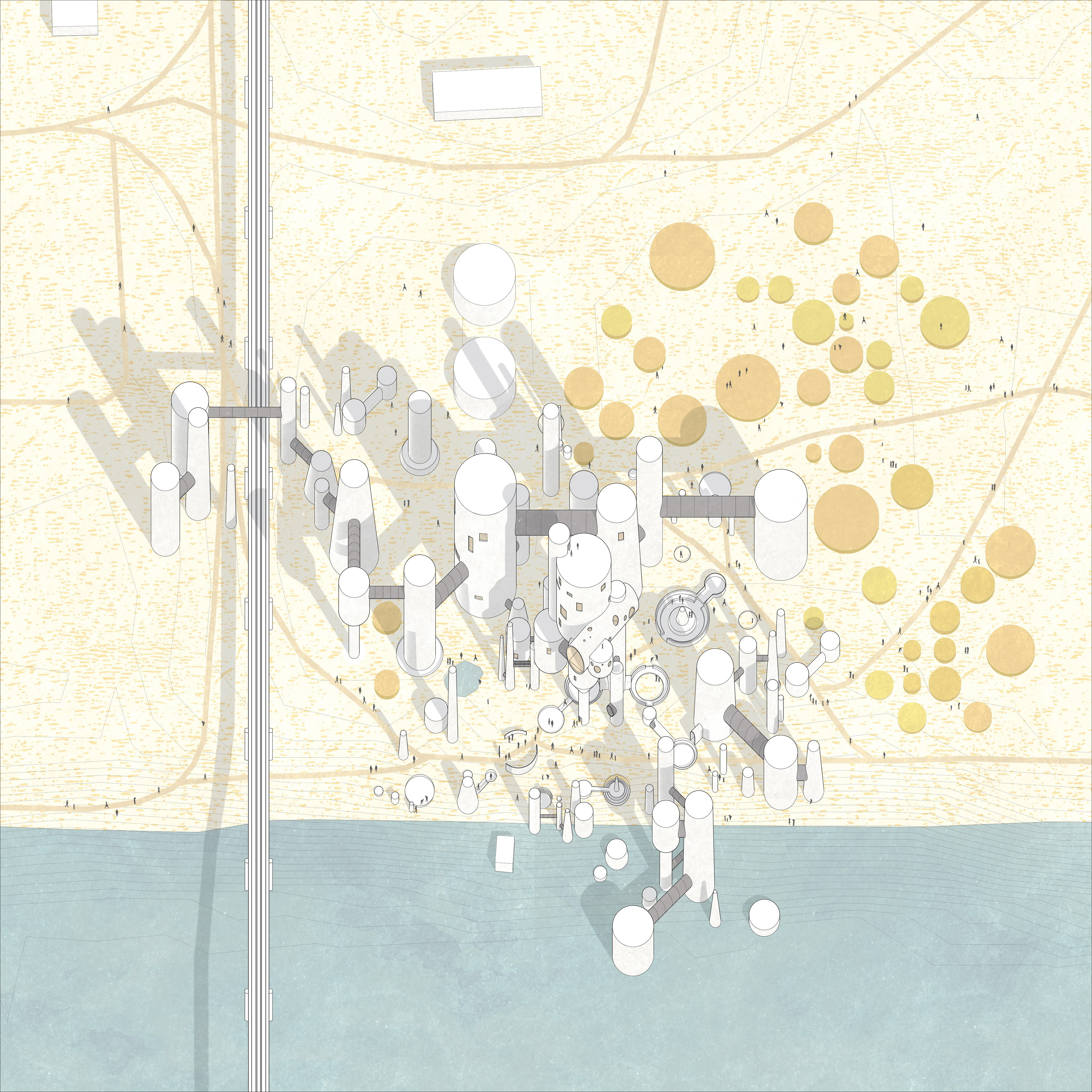
From here we focus on the three sites in Pittsburgh, Brunot Island, Herr's Island, and Strip district, speculate an alternative context through the continuation of industrial past with art and food forming a generative necklace with interventions on each site.
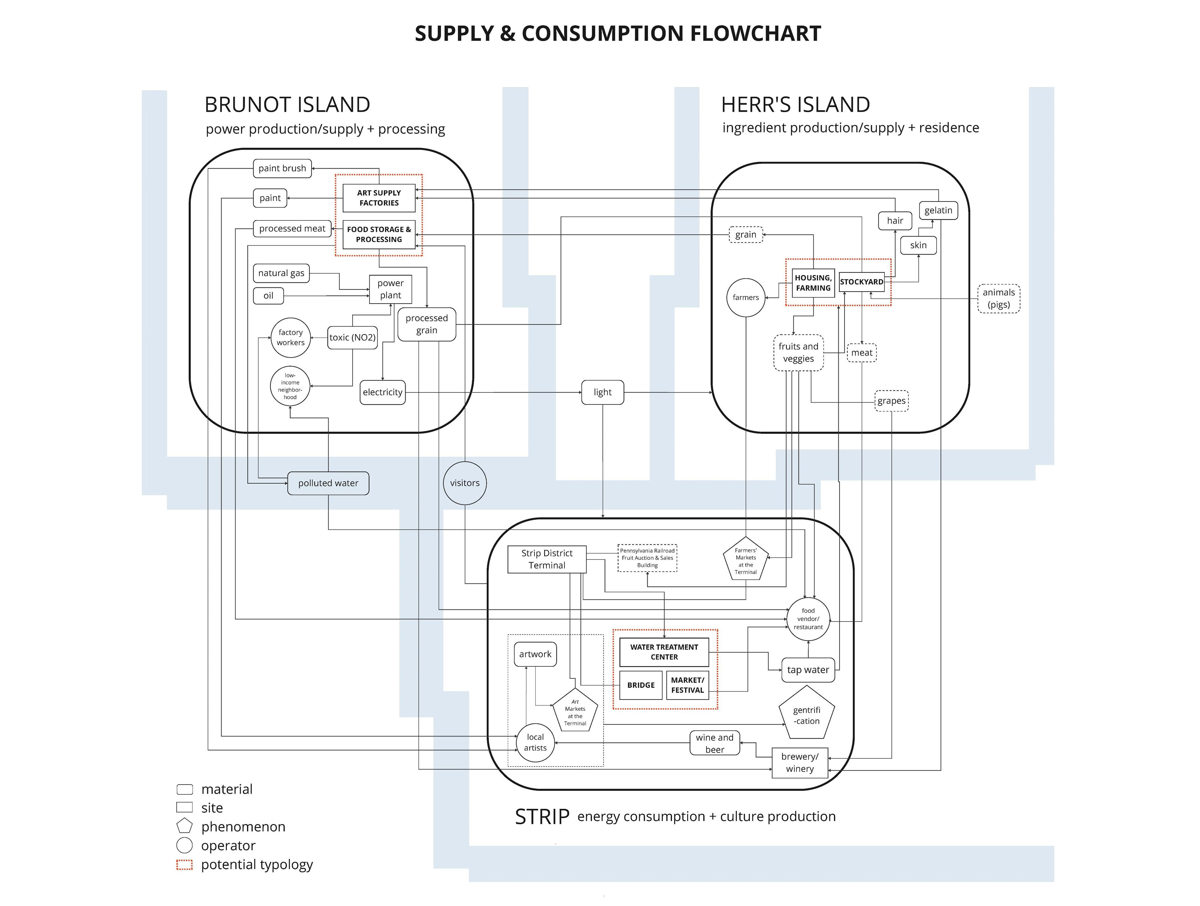
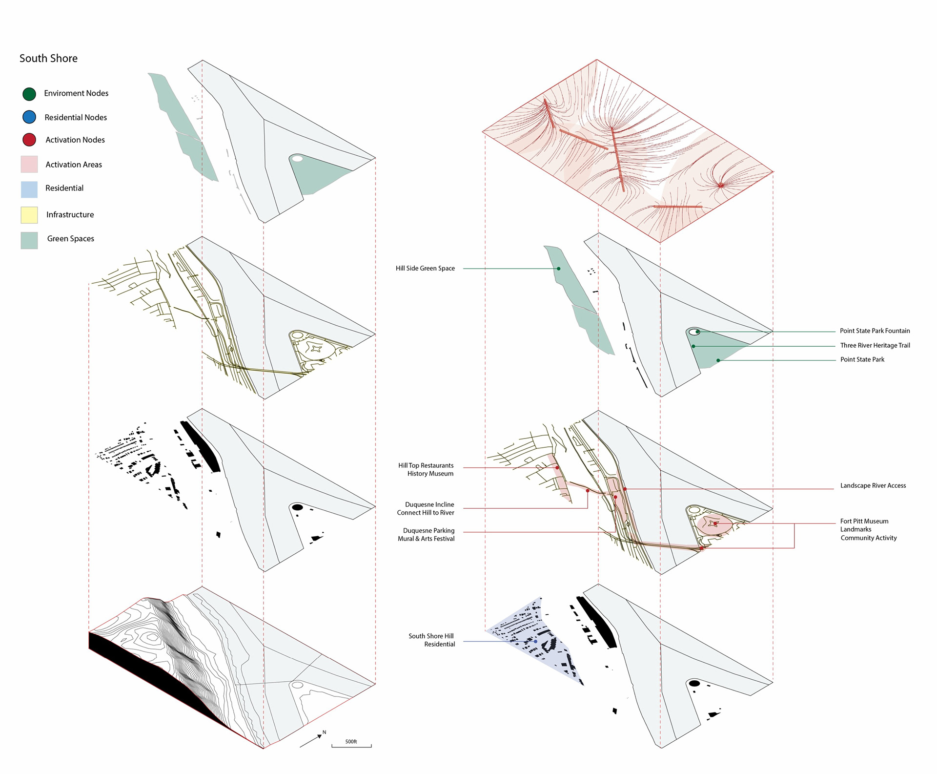
Aiming at an upward shift in economic sectors and the consequent establishment of a new identity, today's Pittsburgh (especially its political authorities) has, in a way, been trying to avoid association with its industrial past as it comes with negative implications related to the city's infamous pollution condition. If we look closely at the civic life, however, we can find traces of Pittsburgh's industrial chain almost everywhere, transcending the limit of time. At Herr's Island, Brunot Island and Strip, three key sites of the supply chain, we started to speculate how Pittsburgh could have been different than what we see today.
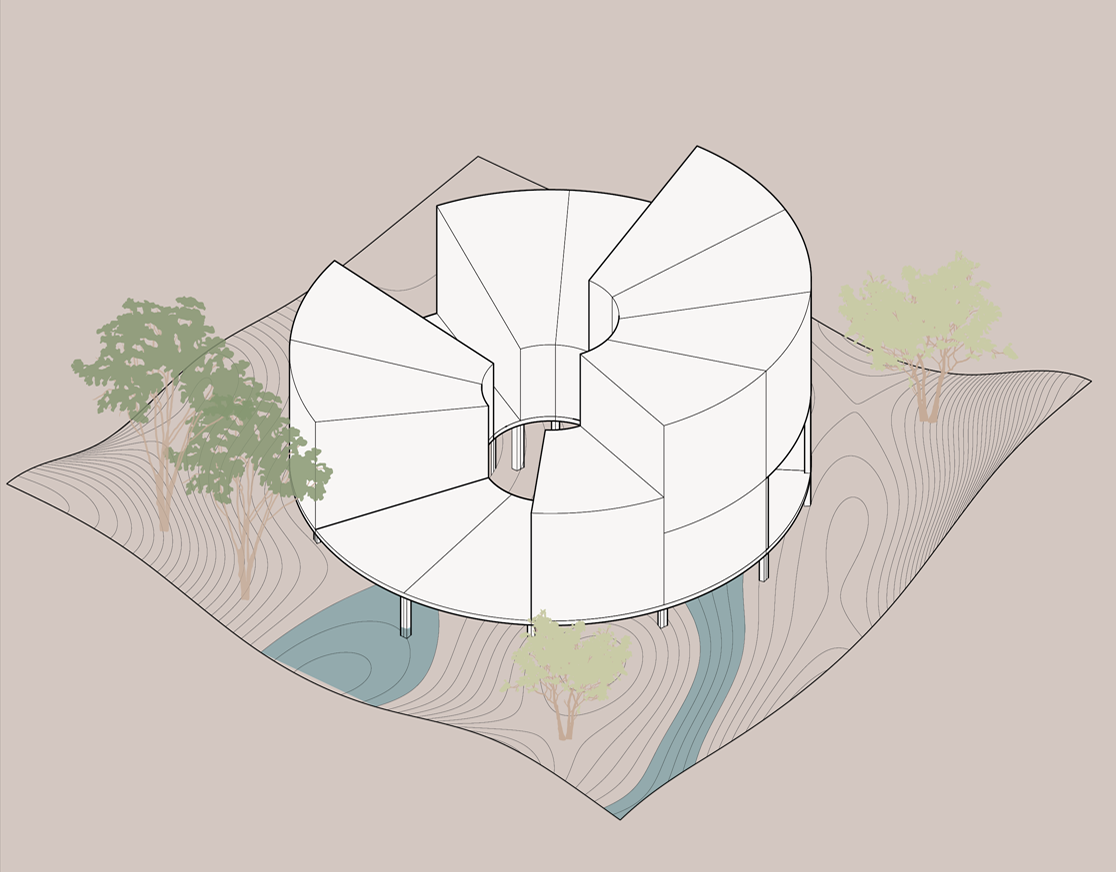
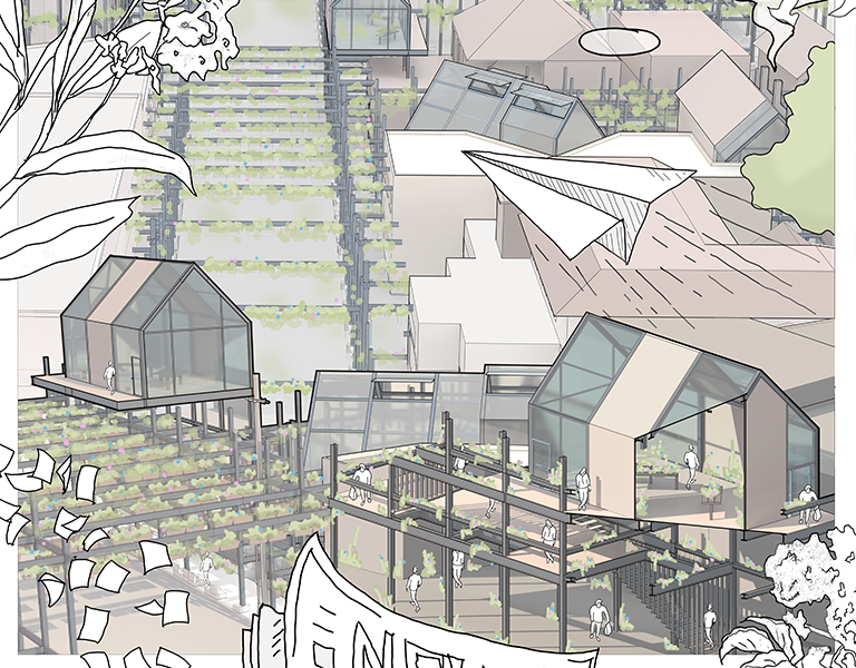
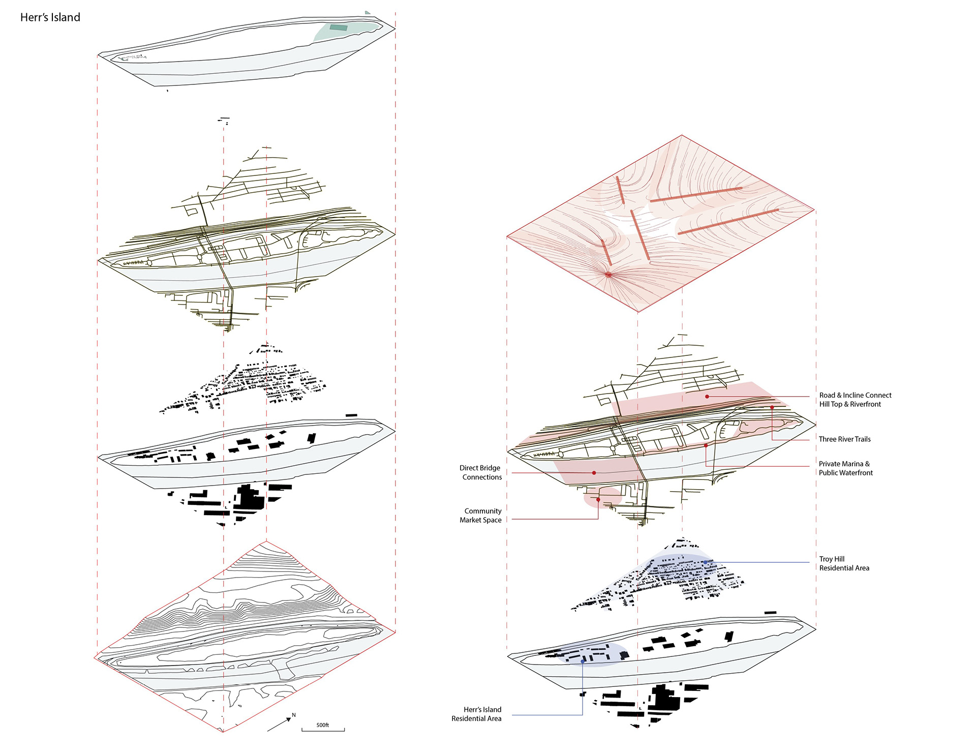
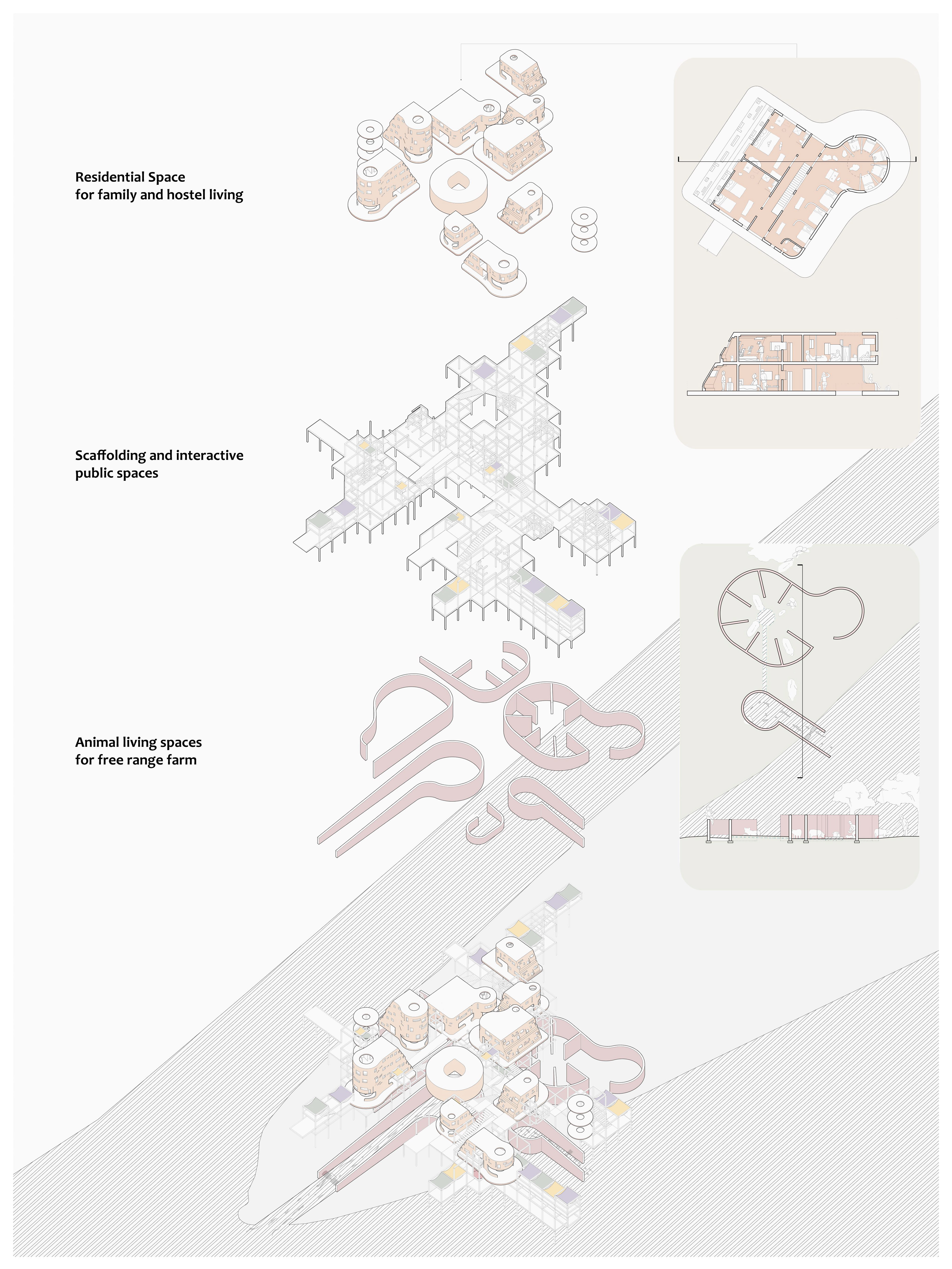
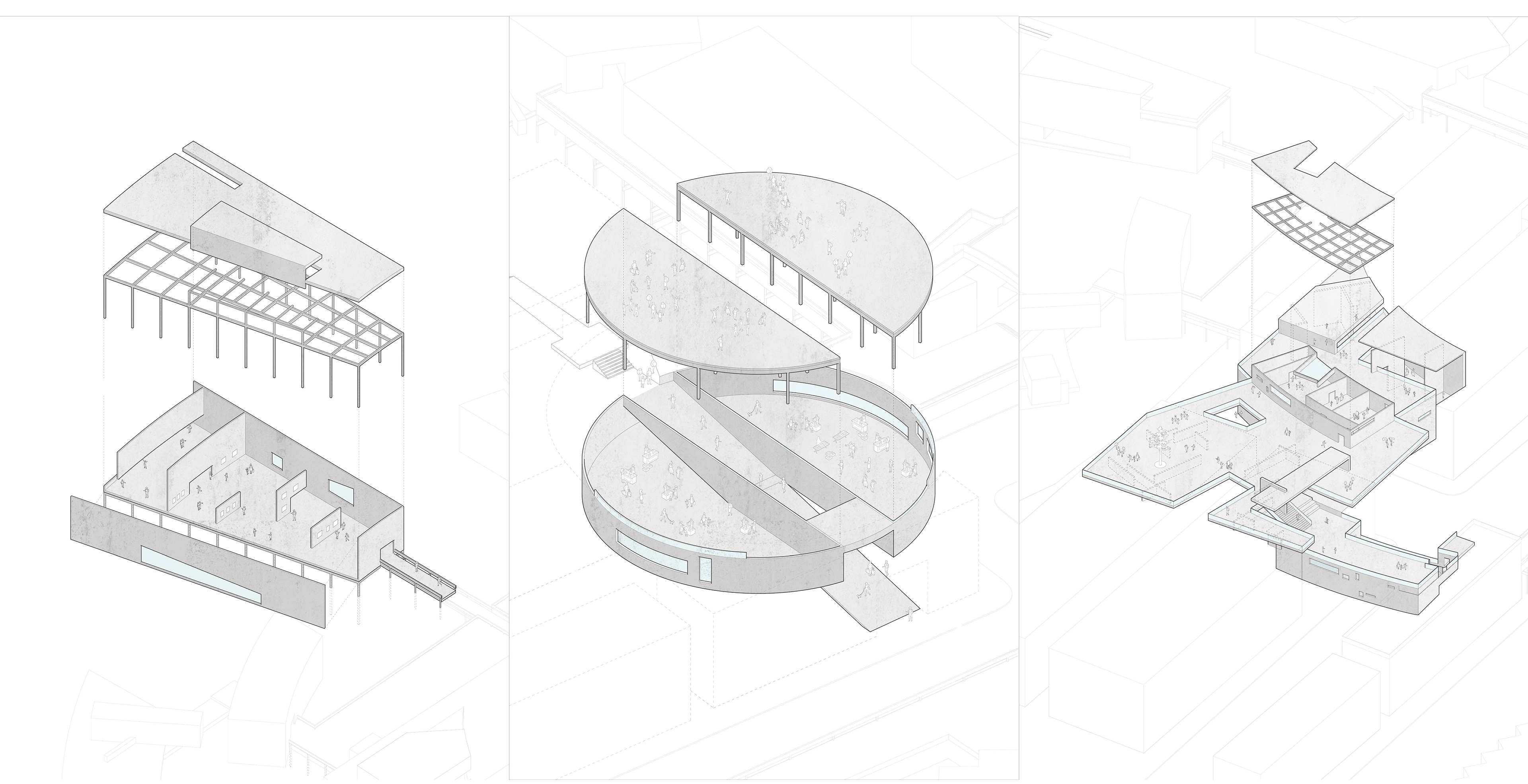
Herr's Island: Free-range Farm, Hostel
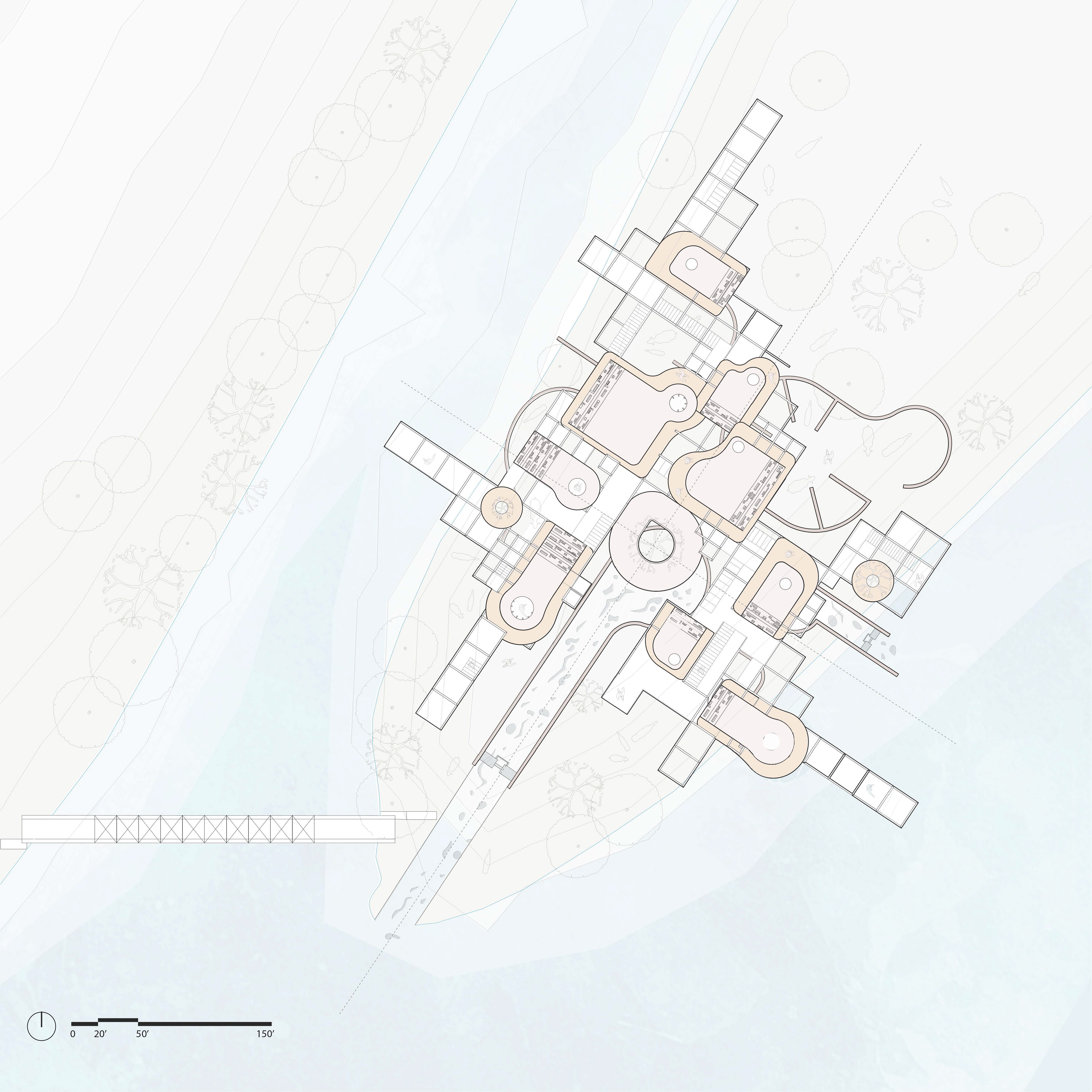
Site plan
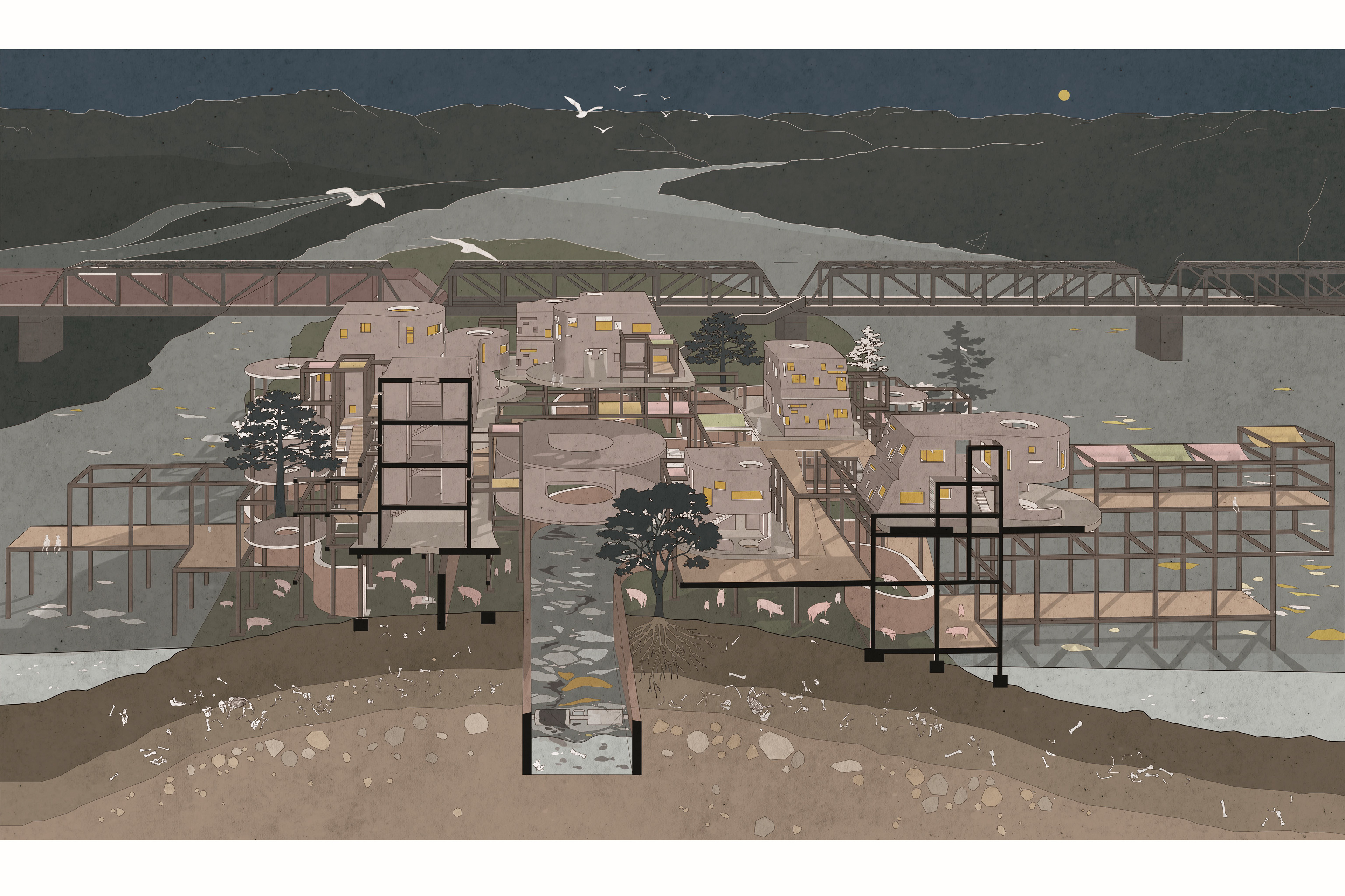
Sectional perspective
Chunk plan and section; exploded axonometric
With its history of livestock industry, Herr's Island has the potential to still play an interesting role in Pittsburgh's supply chain. At the south-west end of the island there is an architecture hybrid of animal's living space and human living space: the merge of a free range animal farm and a boutique hostel that welcomes visitors from nearby. People can access the site through the pedestrian bridge at the south and east edge. The scaffold grid organizes the system of masses, with organic form of animal spaces on the lower level and housing modules on the upper levels. Each housing module has a rectilinear side that contains rooms for family living, and a circular side which is divided into smaller subunits for individuals, along with a shared common area on the first level. The curved housing platforms and the animal's space correspond in their form, and the organizational grid extends the mass to the Monongahela river and circulations, bringing water further into the island from its tip.

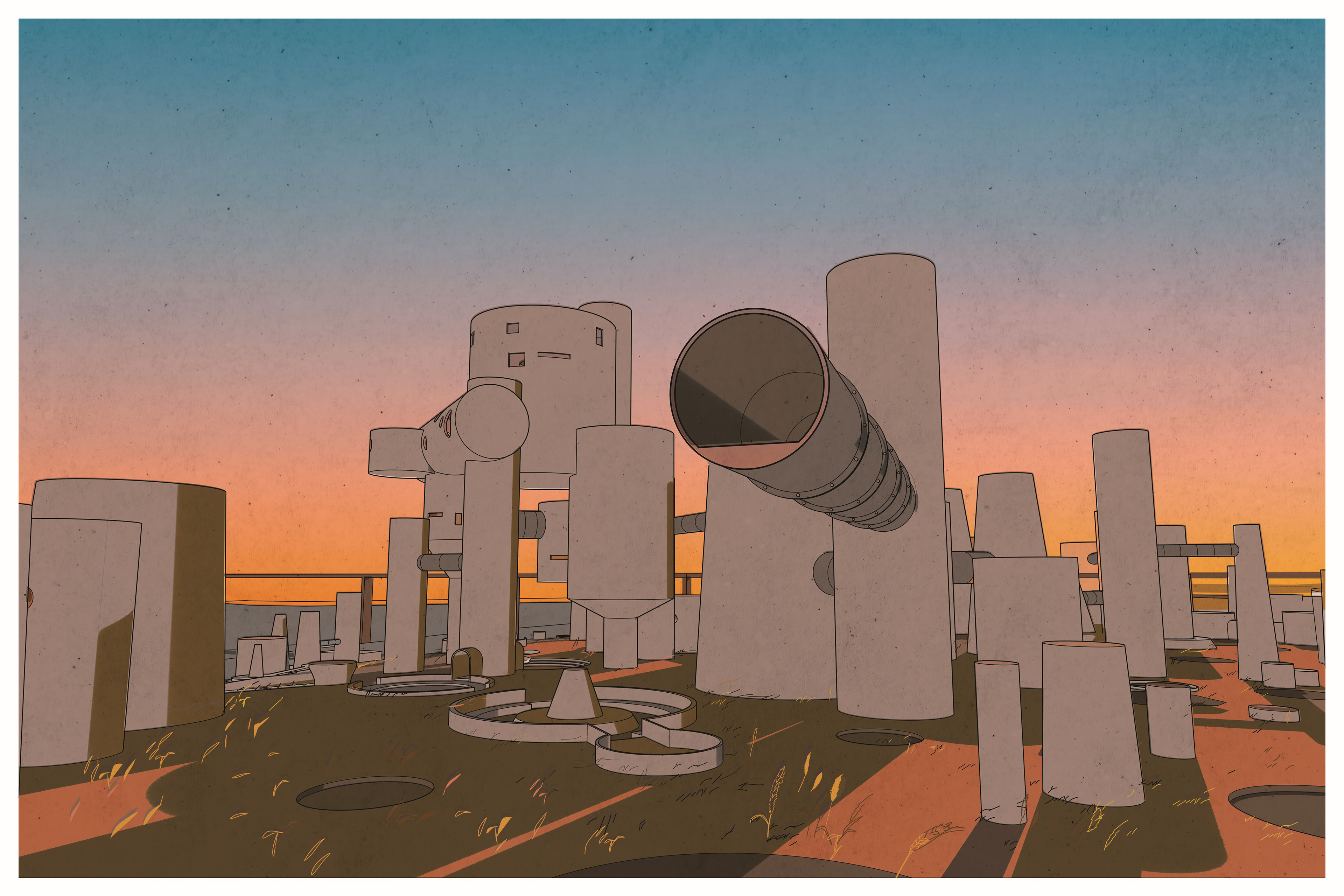
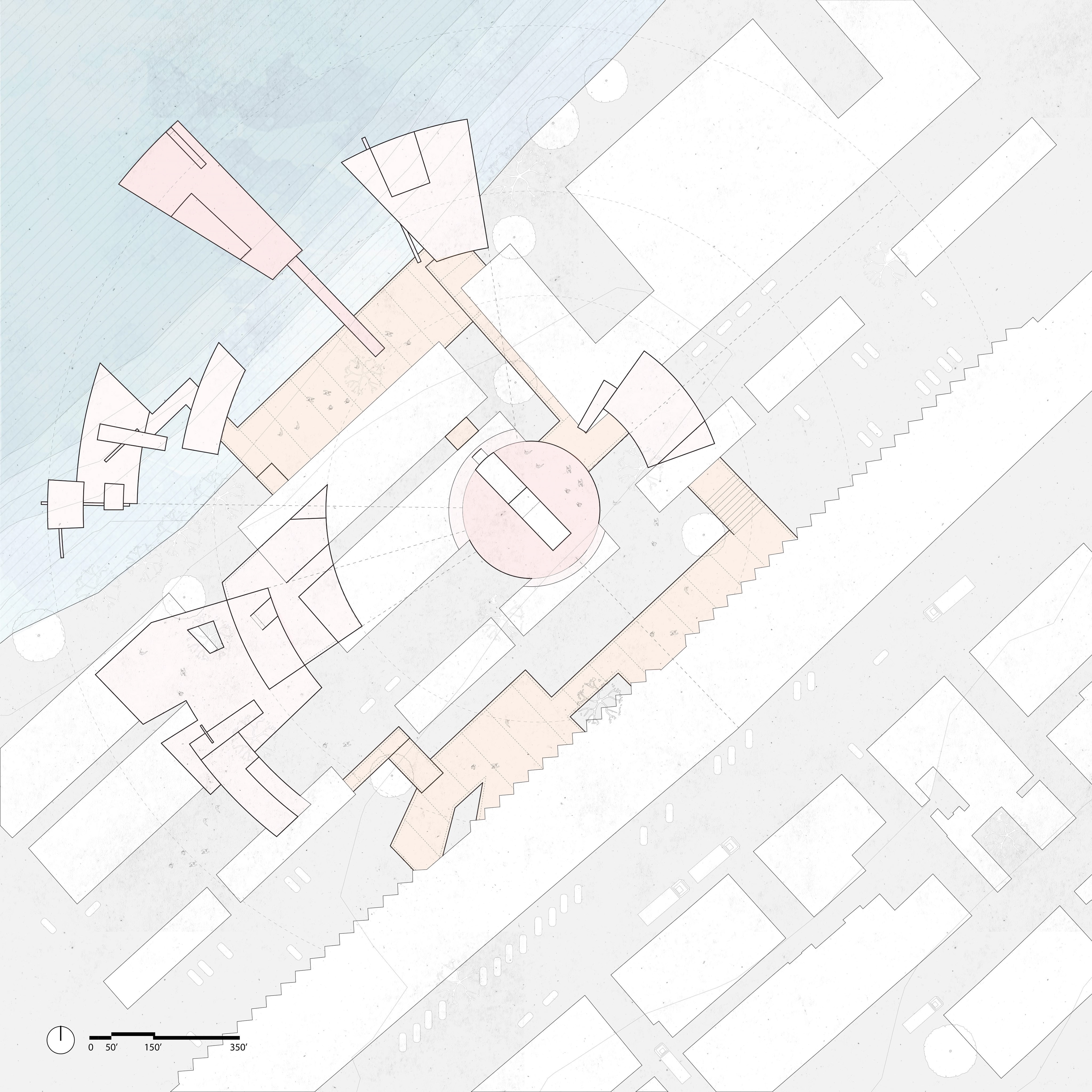
Brunot Island: Grain Silo, Bakery, Bread Museum/Gallery

Site plan
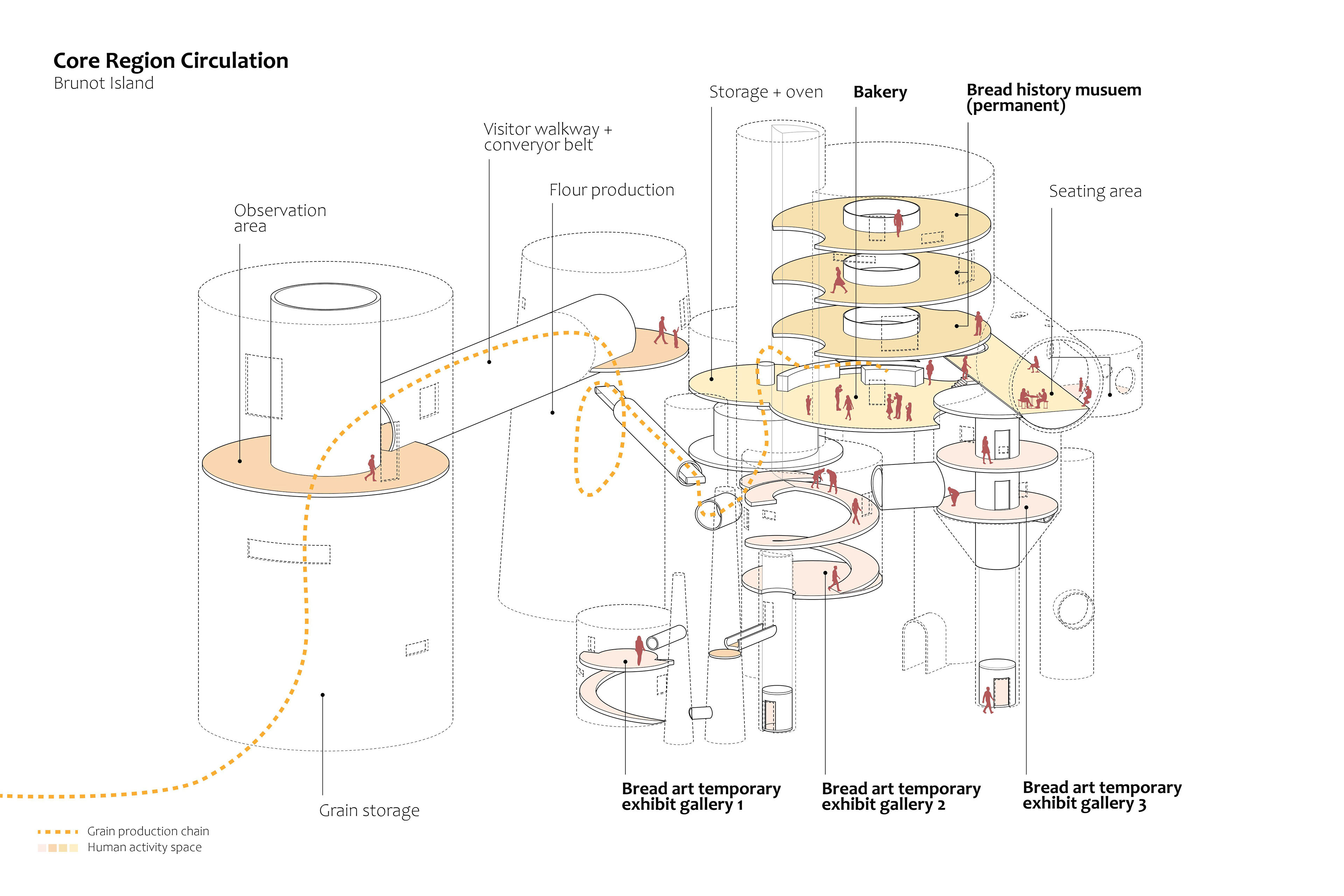
Core region Circulation
Section Perspective
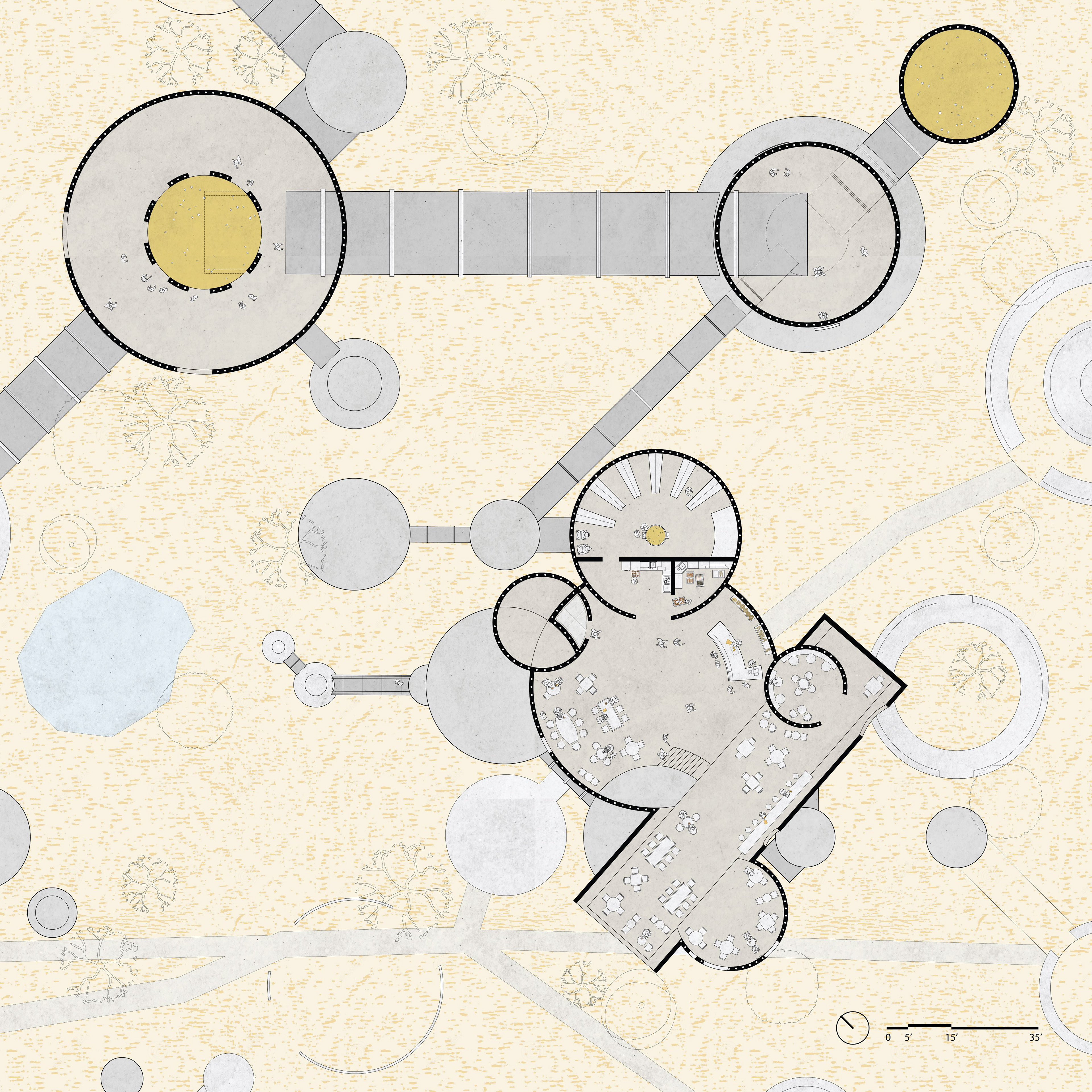
Core region plan
Site axonometric
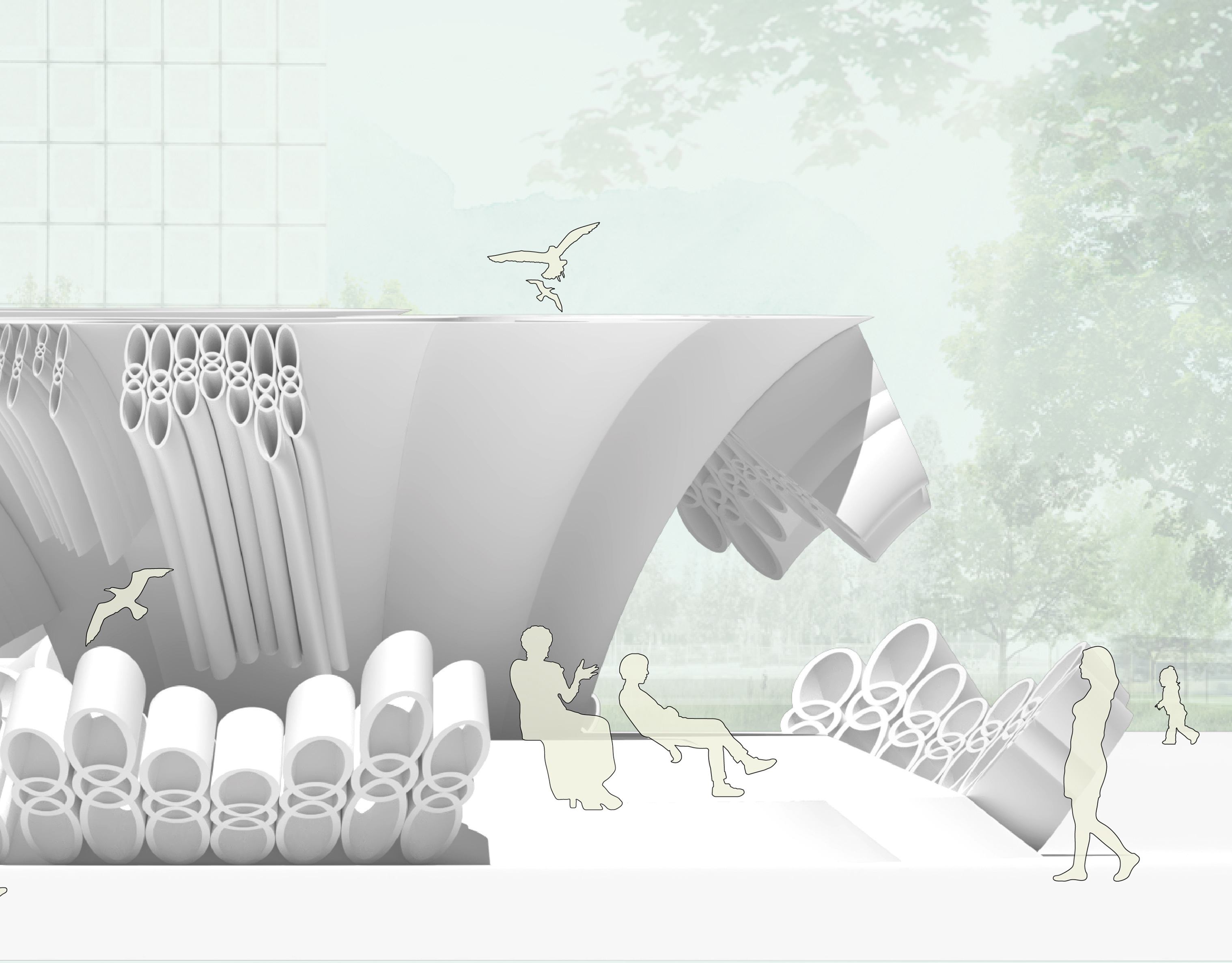
The currently isolated and empty Brunot island with only a few power plants could have become a blooming processing zone for agriculture. Open farmlands and grain silos form a powerful grain supply chain that then goes to both Strip and Herr's as food for people and livestock. The grain silo typology has evolved into a network of nodes across the site, inviting visitors into Brunot's rich production culture by framing an experience through the area. After exiting the bridge, visitors are loosely guided by the silos into a core public zone, with a cluster of masses lifted in the air, which is a complex of a bakery, a permanent museum of grain production history, and several small galleries displaying bread and grain art by different artists. Across the site, grain silos are bridging over bridges, trail routes, and into the water, crossing over with human activities. With the same formal language, there are different scales of silos aiming for public gathering, individual occupancy, or massive industrial production; some of the connectors can be walked through while others allow you to peep in.

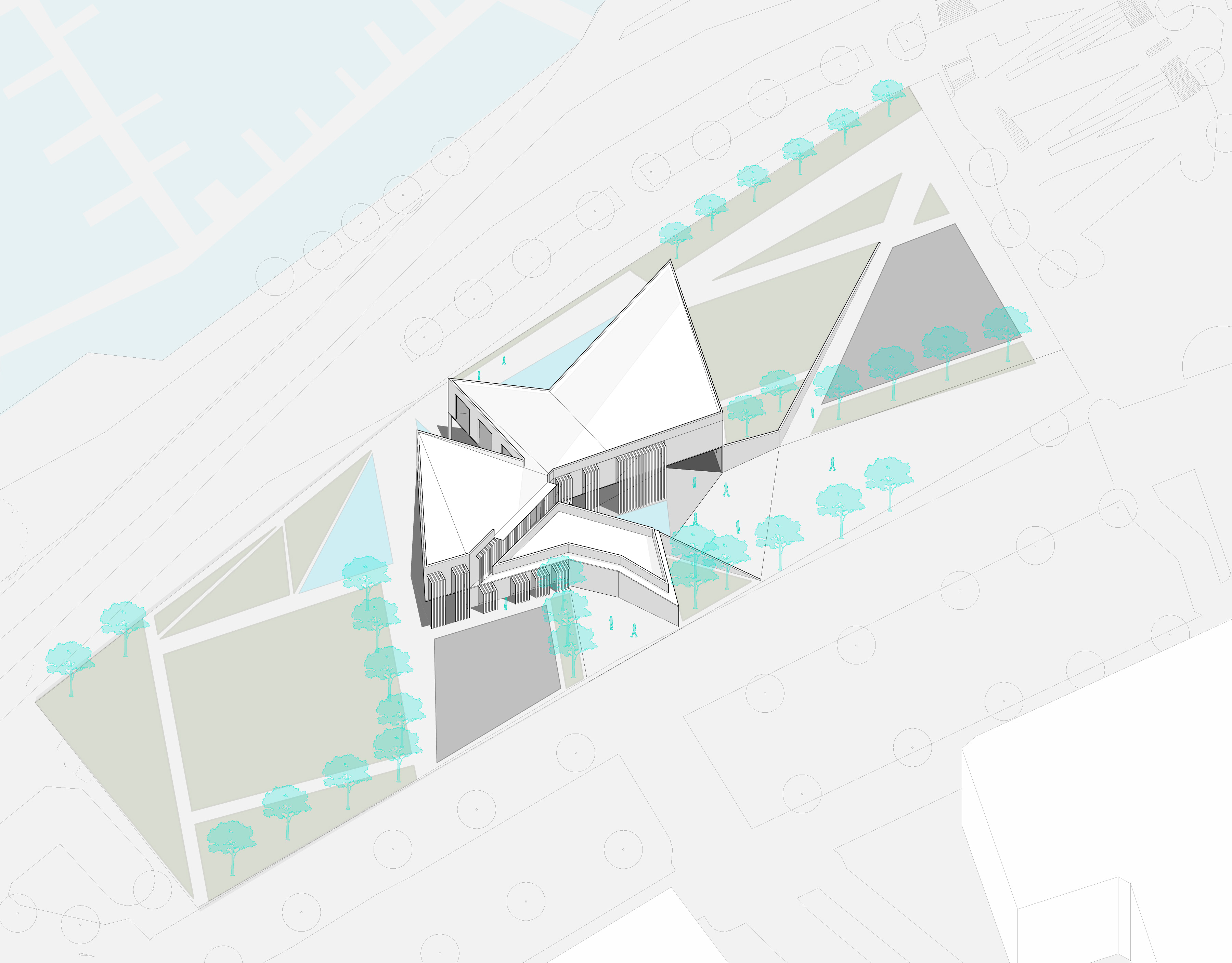
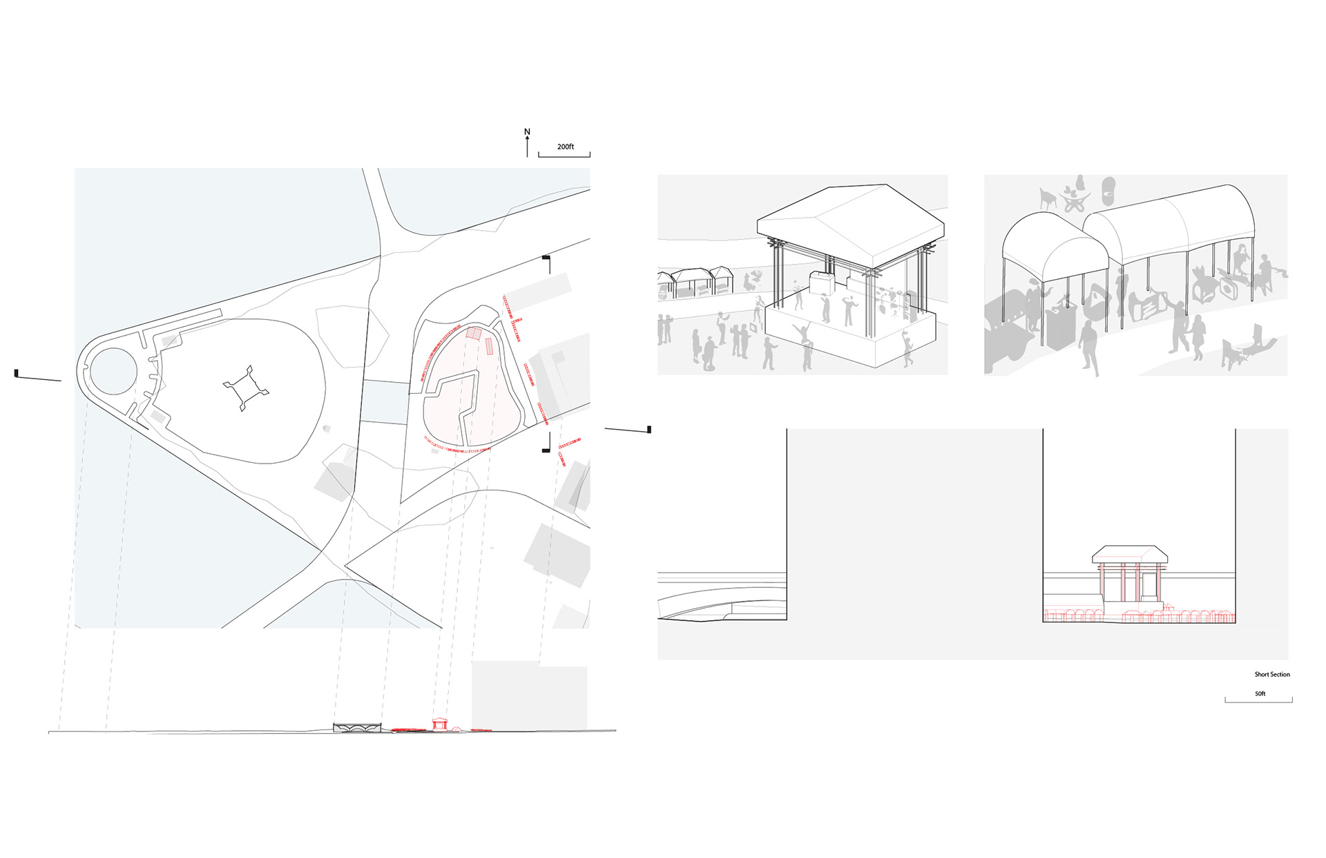
Strip District: Artist Studio, Public Performance/Market Stages
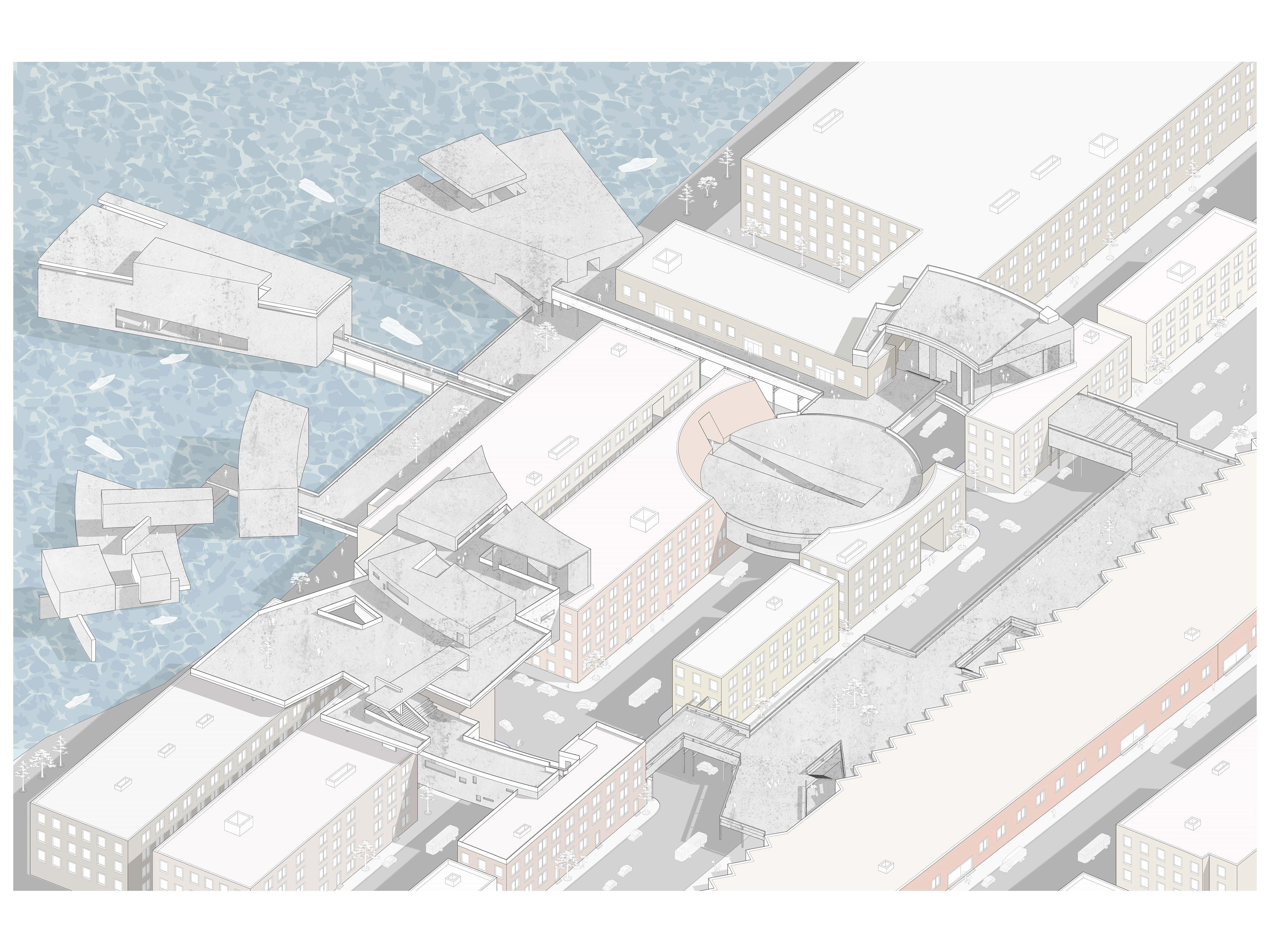
The Strip district is where the grain, meat, and other animal products from the two islands are consumed, but the process is at the same time accompanied by the production of a rich urban culture of dining, shopping, and art. The terminal market extends its power towards the riverfront through a system of roof tops, building edges, and passages across the quite residential buildings. Masses are partially inserted into the residential buildings at key nodes for creating flows. Big open or semi-open spaces are used as casual performance stages, plazas, and markets, and the smaller, more enclosed spaces would become artist studios. The final stop of this system is the studio displaying and selling artworks above the water.

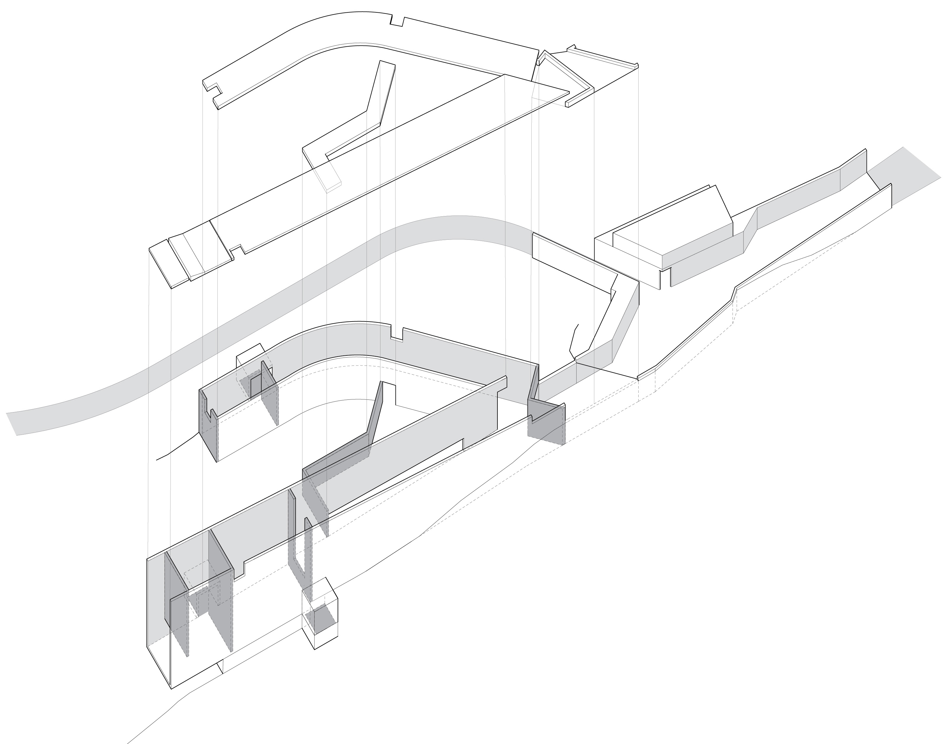
Three Sites Connections: Long Section